Log in
All resources
Create a design
219 Free Images of French Language Maps Of The World
bibliothèque nationale de france
atlas minor gerardi mercatoris (1614, maps)
atlas géographique des quatre parties du monde (delisle)
maps of alsace by guillaume sanson
carte de la moldavie pour servir à l'histoire militaire de la guerre entre les russes et les turcs - levés par l'etat-major sous la direction de f.g. de bawz... echelle de 10 heures de moldavie, 50... - btv1b53100577d
leonard schenk jansz.
1690s maps of baden-württemberg
1690s maps of alsace
mappe-monde geo-hydrographique (sanson and jaillot, 1674)
atlas, ou représentation du monde universel et des parties d'icelui, faicte en tables et descriptions très amples et exactes, divisé en deux tomes. édition nouvelle... - btv1b53103889w
18th-century maps of western europe
1754 maps of europe
maps of alsace by guillaume sanson
1690s maps of baden-württemberg
maps of italy by sanson and cordier
bibliothèque nationale de france
maps of alsace by guillaume sanson
1660s maps of baden-württemberg
maps of alsace by guillaume sanson
1690s maps of baden-württemberg
maps of alsace by guillaume sanson
1660s maps of alsace
bibliothèque nationale de france
sanson map of lorraine
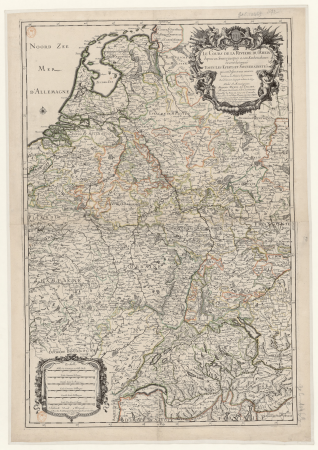
maps of the course of the rhine by guillaume sanson
bibliothèque nationale de france
mappe-monde geo-hydrographique (sanson and jaillot, 1674)
bibliothèque nationale de france
maps by alexis-hubert jaillot
old maps of the tyrol
mappe-monde by guillaume delisle (18th century)
1700s maps of the world
1760s maps of the iberian peninsula
1762 maps of spain
18th-century double hemisphere world maps
1760s maps of the world
mappe-monde geo-hydrographique (sanson and jaillot, 1674)
louis cordier
map of the upper rhenian circle by sanson
maps by nicolas sanson
eran laor cartographic collection
jacques chiquet
antoine-françois tardieu
1800s maps of hispaniola
antoine-françois tardieu
1800s maps of hispaniola
sanson maps of asia
1670s maps of asia
maps of alsace by guillaume sanson
1690s maps of alsace
1690s maps of baden-württemberg
1690s maps of alsace
atlas géographique des quatre parties du monde (delisle)
18th-century maps of the world
mappe-monde geo-hydrographique (sanson and jaillot, 1674)
louis cordier
19th-century maps of greece
pierre françois tardieu
maps of south america by mercator-hondius
bibliothèque nationale de france
map of the upper rhenian circle by sanson
1690s maps of hesse
bibliothèque nationale de france
guillaume sanson
atlas minor gerardi mercatoris (1614, maps)
maps of africa by mercator-hondius
atlas minor gerardi mercatoris (1614, maps)
maps of china by mercator-hondius
maps of the iberian peninsula by mercator-hondius
atlas minor gerardi mercatoris (1614, maps)
atlas minor gerardi mercatoris (1614, maps)
maps of moers by johannes mercator
atlas minor gerardi mercatoris (1614, maps)
maps of asia by mercator-hondius
atlas minor gerardi mercatoris (1614, maps)
maps of paradise by mercator-hondius
atlas minor gerardi mercatoris (1614, maps)
maps of abyssinia by mercator-hondius
atlas minor gerardi mercatoris (1614, maps)
maps of tartary by mercator-hondius
atlas minor gerardi mercatoris (1614, maps)
maps of virginia by mercator-hondius
atlas minor gerardi mercatoris (1614, maps)
maps of the caribbean by mercator-hondius
maps of the ottoman empire by mercator-hondius
atlas minor gerardi mercatoris (1614, maps)
atlas minor gerardi mercatoris (1614, maps)
maps of asia minor by mercator-hondius
atlas minor gerardi mercatoris (1614, maps)
maps of lake geneva by jacques goulart
atlas minor gerardi mercatoris (1614, maps)
maps of mexico by mercator-hondius
atlas minor gerardi mercatoris (1614, maps)
maps of valencia by mercator-hondius
atlas minor gerardi mercatoris (1614, maps)
maps of portugal by fernando álvares seco
atlas minor gerardi mercatoris (1614, maps)
maps of south asia by mercator-hondius
atlas minor gerardi mercatoris (1614, maps)
maps of guinea by mercator-hondius
atlas minor gerardi mercatoris (1614, maps)
maps of the americas by mercator-hondius
maps of the magellan straits by lambert cornelis
atlas minor gerardi mercatoris (1614, maps)
atlas minor gerardi mercatoris (1614, maps)
maps of ceylon by petrus plancius
atlas minor gerardi mercatoris (1614, maps)
maps of andalusia by mercator-hondius
atlas minor gerardi mercatoris (1614, maps)
maps of provence by pierre-jean de bompar
atlas minor gerardi mercatoris (1614, maps)
maps of cyprus by mercator-hondius
maps of aragon and catalonia by mercator-hondius
atlas minor gerardi mercatoris (1614, maps)
maps of the malay archipelago by mercator-hondius
atlas minor gerardi mercatoris (1614, maps)
atlas minor gerardi mercatoris (1614, maps)
maps of barbary coast by mercator-hondius
pieter verbiest (ii)
maps from gallica
atlas minor gerardi mercatoris (1614, maps)
maps of japan by mercator-hondius
atlas minor gerardi mercatoris (1614, maps)
maps of the holy land by mercator-hondius
atlas minor gerardi mercatoris (1614, maps)
maps of europe by mercator-hondius
atlas minor gerardi mercatoris (1614, maps)
maps of castile by mercator-hondius
atlas minor gerardi mercatoris (1614, maps)
maps of persia by mercator-hondius
atlas minor gerardi mercatoris (1614, maps)
maps of morocco by mercator-hondius
atlas minor gerardi mercatoris (1614, maps)
maps of south america by mercator-hondius
maps of biscay and gipuzkoa by mercator-hondius
atlas minor gerardi mercatoris (1614, maps)
atlas géographique des quatre parties du monde (delisle)
18th-century maps of france
atlas géographique des quatre parties du monde (delisle)
folded maps
atlas géographique des quatre parties du monde (delisle)
18th-century maps of africa
atlas géographique des quatre parties du monde (delisle)
folded maps
atlas géographique des quatre parties du monde (delisle)
map of italy by guillaume delisle (1700)
atlas géographique des quatre parties du monde (delisle)
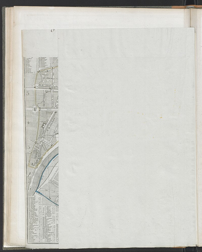
maps of paris by guillaume delisle
atlas géographique des quatre parties du monde (delisle)
map of europe by guillaume delisle (1700)
mappe-monde by guillaume delisle (18th century)
claude auguste berey
atlas, ou représentation du monde universel et des parties d'icelui, faicte en tables et descriptions très amples et exactes, divisé en deux tomes. édition nouvelle... - btv1b53103889w
maps facing west
antoine-françois tardieu
1800s maps of hispaniola
maps of alsace by guillaume sanson
bibliothèque nationale de france
cartouches by alexis-hubert jaillot
cartouches by sanson family
1760s maps of the americas
1764 maps
sanson maps of the netherlands
alexis-hubert jaillot
maps of alsace by guillaume sanson
bibliothèque nationale de france
maps of île-de-france by françois de la guillotière
atlas minor gerardi mercatoris (1614, maps)
atlas géographique des quatre parties du monde (delisle)
map of scandinavia by guillaume de l'isle (1706)
atlas géographique des quatre parties du monde (delisle)
map of scandinavia by guillaume de l'isle (1706)
carte du mexique et de la floride by guillaume delisle (1703)
bibliothèque nationale de france
maps of alsace by guillaume sanson
1660s maps of baden-württemberg
mappe-monde geo-hydrographique (sanson and jaillot, 1674)
louis cordier
bibliothèque nationale de france
sanson maps of south america
sanson maps of the holy land
old maps of canaan
1750s maps of north america
solomon bolton
carte de la moldavie pour servir à l'histoire militaire de la guerre entre les russes et les turcs - levés par l'etat-major sous la direction de f.g. de bawz... echelle de 10 heures de moldavie, 50... - btv1b53100577d
leonard schenk jansz.
carte de la moldavie pour servir à l'histoire militaire de la guerre entre les russes et les turcs - levés par l'etat-major sous la direction de f.g. de bawz... echelle de 10 heures de moldavie, 50... - btv1b53100577d
leonard schenk jansz.
carte de la moldavie pour servir à l'histoire militaire de la guerre entre les russes et les turcs - levés par l'etat-major sous la direction de f.g. de bawz... echelle de 10 heures de moldavie, 50... - btv1b53100577d
leonard schenk jansz.
carte de la moldavie pour servir à l'histoire militaire de la guerre entre les russes et les turcs - levés par l'etat-major sous la direction de f.g. de bawz... echelle de 10 heures de moldavie, 50... - btv1b53100577d
leonard schenk jansz.
carte de la moldavie pour servir à l'histoire militaire de la guerre entre les russes et les turcs - levés par l'etat-major sous la direction de f.g. de bawz... echelle de 10 heures de moldavie, 50... - btv1b53100577d
leonard schenk jansz.
carte de la moldavie pour servir à l'histoire militaire de la guerre entre les russes et les turcs - levés par l'etat-major sous la direction de f.g. de bawz... echelle de 10 heures de moldavie, 50... - btv1b53100577d
leonard schenk jansz.
1780s maps of the americas
1786 maps
maps by willem and johannes blaeu
1610s maps of the americas
jean-fréderic phélypeaux
guillaume dheulland
atlas, ou représentation du monde universel et des parties d'icelui, faicte en tables et descriptions très amples et exactes, divisé en deux tomes. édition nouvelle... - btv1b53103889w
1630s maps of peru
atlas, ou représentation du monde universel et des parties d'icelui, faicte en tables et descriptions très amples et exactes, divisé en deux tomes. édition nouvelle... - btv1b53103889w
1630s maps of bavaria
atlas, ou représentation du monde universel et des parties d'icelui, faicte en tables et descriptions très amples et exactes, divisé en deux tomes. édition nouvelle... - btv1b53103889w
17th-century maps of guyana
bibliothèque nationale de france
hendrik de leth
101 - 200 of 219
Next page
/ 3